France has 12 time zones, and Russia covers roughly 11 hours from west to east. That means two people in the same country can live on very different “clocks.”
The reason is simple on the surface. Earth spins, so the Sun shows up at different times depending on longitude. As a result, many places follow multiple time zones so daily life stays practical.
Still, not every big country does the same thing. Some keep one national time. Others slice their territory into many zones. So why do countries with similar land size end up with different systems?
In most cases, it comes down to geography, politics, and history. Geography pushes countries to split time when they stretch far east to west. Politics can merge or separate regions for unity, trade, or convenience. History adds another layer when empires and overseas territories left far-flung clocks behind.
If you’ve ever wondered why your flight crosses time zones mid-country, or why “noon” doesn’t mean the same thing everywhere, you’re in the right place.
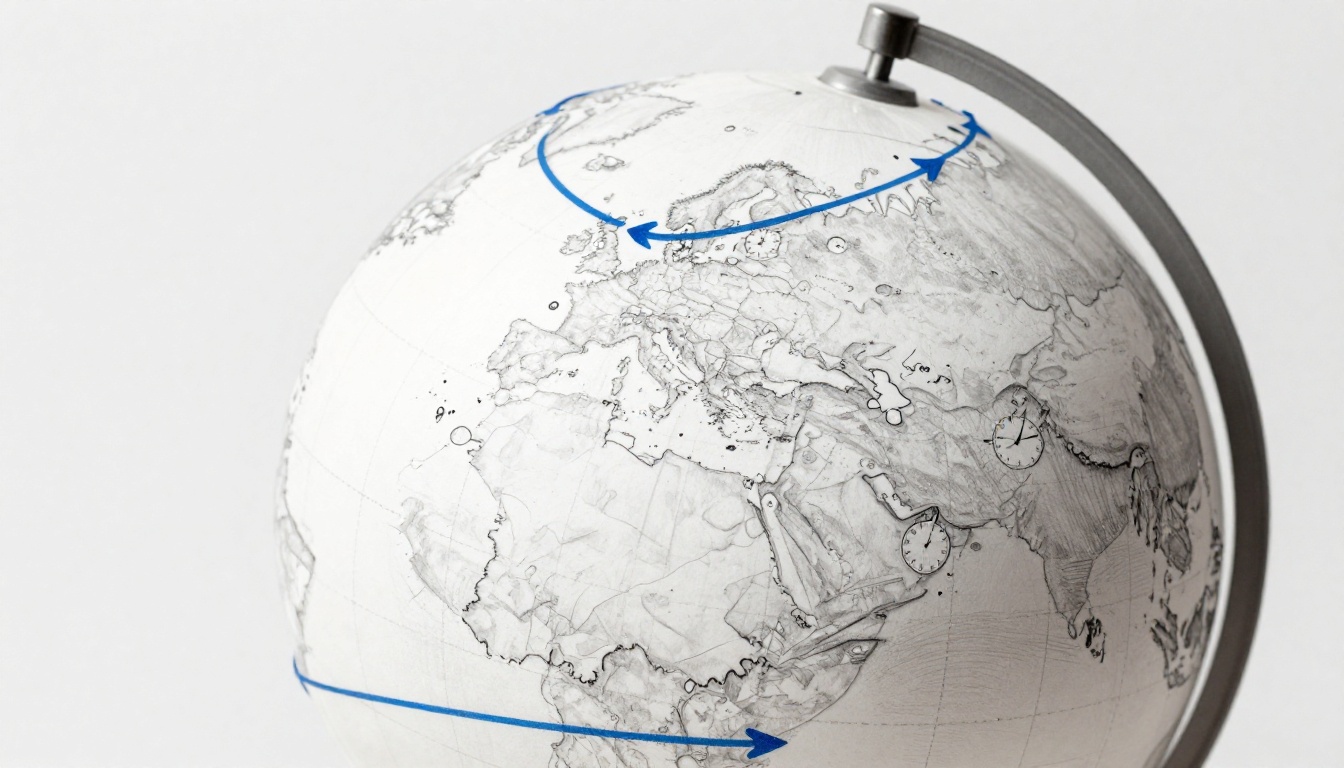
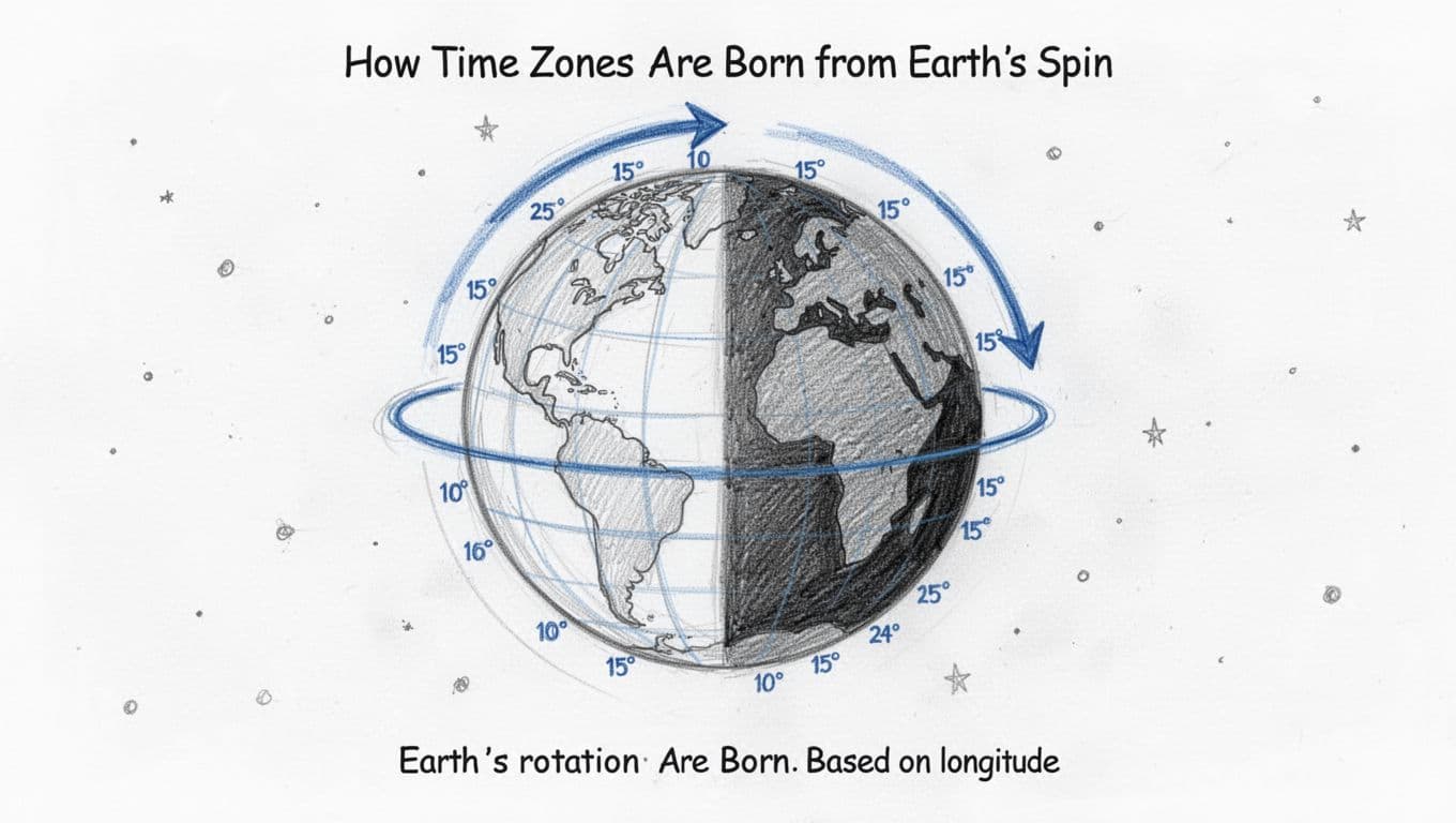
How Time Zones Are Born from Earth’s Spin
Earth rotates once every 24 hours. Because of that, the Sun appears to move across the sky. Locations on opposite sides of the planet also experience day and night at different times.
Longitude lines help translate that motion into time. The Earth rotates about 15 degrees per hour (360 degrees divided by 24 hours). So, a country that spans a lot of degrees east to west will naturally face bigger clock differences.
Think of it like slicing a pizza. Each slice is roughly the same slice of “time” as the pizza rotates past you. One slice is closer to sunrise, another slice is closer to sunset.
In real life, most countries do not pick time zones by checking the Sun every morning. Instead, they use a shared reference called UTC (Coordinated Universal Time). Then they set local time as an offset from UTC, like UTC+1 or UTC-5.
Now here’s the key. Small countries often don’t need multiple time zones. Even if their sunrise times shift a bit, the difference can stay manageable. Meanwhile, large countries can end up with a huge mismatch between the “clock time” people use and the “Sun time” they experience.
That mismatch shows up fast. When a country ignores its east-west spread, the western side can get very early mornings by the clock. The eastern side might see late sunsets and evenings that feel out of sync.
Once you picture time zones as “longitude-based slices,” the rest gets easier. Geography sets the stage. Then people decide what feels workable.
Geography: The Main Driver Behind Multiple Zones
Geography is the loudest reason countries split time. When land stretches far east to west, sunrise and sunset shift a lot. In addition, people expect their schedules to match daylight. That includes school hours, work shifts, and public transit.
Imagine living in a wide country where the Sun rises 2 or 3 hours earlier on one side. If everyone uses the same clock, one region gets long, dark mornings. The other region gets bright late afternoons.
So countries often align time zones with practical regional needs. In many cases, the “cut lines” land near where the biggest daylight differences start to cause trouble. Sometimes they follow straight lines. Other times they bend around borders, rivers, and coastlines.
Russia shows the classic version of this pattern. Its territory spans a huge range of longitudes, from the Baltic region in the west to the far east near the Pacific. That spread alone helps explain why Russia operates across 11 time zones in everyday life.
The United States and Canada also fit the “east-west spread” story, though they handle it with smaller splits. The US commonly follows six time zones across its states and territories. Canada similarly runs on six time zones, including adjustments like Newfoundland’s offset.
If you’ve ever looked at a map and thought, “That’s not that wide,” it helps to remember that time zones count longitude range, not just land area. You can have a country that’s not massive in total size but still stretches far enough to require different clocks.
Here’s the practical result. When countries set multiple time zones, each zone makes local noon feel closer to the Sun’s highest point. It’s not perfect, but it helps daily routines line up with daylight.
Ignoring geography does cause odd moments. For example, “12:00” might not feel like noon if the Sun’s peak happens near 2:00 instead. People can adapt, but they adapt with effort: shift routines, change commuting times, and deal with the mental tax of constant time mismatch.
Australasia and South America show how the same force can create different outcomes. Australia follows eight or more time zones, driven by long distances between major population areas. Brazil follows four time zones, mainly to handle daylight differences between the east and the west.
Politics Steps In to Tweak the Lines
Geography sets the need. Politics decides the shape of the solution.
A government might choose multiple time zones to keep business, transit, and local schedules aligned with daylight. Yet it can also choose one time to support national unity. It depends on what officials value more: local convenience or national uniformity.
Australia is a great example of political power over timekeeping. Instead of one nationwide system, Australian states and territories use arrangements that reflect local needs and history. That’s why you often hear “Australia has multiple time zones” as a simple fact, even when the country’s daylight changes do not look the same everywhere.
Politics can also create half-hour offsets. Those offsets help fine-tune schedules, especially when a region sits between “standard” one-hour steps. The result is a system that can feel messy on paper, but workable for residents.
Brazil offers another political lesson. Brazil has four time zones, and the national setup helps coordinate large regions while still respecting major daylight differences.
Meanwhile, some countries pick a single clock even if geography suggests they should split. The next sections explain why, especially for China and India.
When you see “time zone lines” on a map, remember they’re not only science. They’re also decisions about people, travel, and public life.
History Creates Distant Time Zone Clusters
History can lock in patterns that geography alone would not pick. Emigration, colonial administration, wartime schedules, and shipping routes all shaped how time got standardized across regions.
When European powers managed colonies across oceans, they often set time rules that suited administration and communication. Over time, those rules became local customs. Even after independence or border changes, many areas kept the time framework they were given.
France is the best known example for this kind of legacy. The modern French Republic includes overseas territories spread across the globe. As a result, it often appears at the top of lists for the most time zones, because its administrative footprint stretches far in multiple directions.
The United Kingdom also has a history of overseas connections. Those networks influenced timekeeping choices across territories. Today, the UK’s time zone count reflects that mix of mainland and overseas holdings.
In short, history doesn’t only affect what countries own. It affects how they coordinate clocks today.
For an exact overview of how France’s mainland and overseas territories keep time, see Time in France on Wikipedia.
Top Countries Juggling the Most Time Zones
Here’s the big pattern most people miss: the countries with the most time zones usually have either wide east-west land spans or overseas territories that reach far from the mainland.
If you want a quick reference list, you can compare counts across sources like Countries with the Most Time Zones 2026. For a broader table view, Time Zones by Country 2026 is also useful.
To keep it simple, here’s a practical snapshot using counts commonly cited for day-to-day time zone use, including overseas regions where relevant.
| Country | Common time zone count (incl. territories) | Why it ends up with multiple zones |
|---|---|---|
| France | 12 | Overseas territories spread across many longitudes |
| Russia | 11 | Huge east-west span across Europe to Asia |
| United States | 6 | Wide coverage across states, plus Alaska and Hawaii |
| Canada | 6 | Large east-west land range across provinces |
| Australia | 8+ | Long distances between population areas and territories |
| Brazil | 4 | East-west daylight differences across regions |
A quick note: some lists count differently, depending on how they treat small territories and polar claims. Still, the main story stays the same: wide reach needs more local time.
For an additional reference that includes dependent territories, check List of time zones by country.
France Tops the List with Overseas Reach
France often wins “most time zones” because its territory is not only mainland Europe. It includes overseas regions scattered around the globe.
Metropolitan France uses Central European Time, and it follows daylight saving changes on the usual European schedule. However, each overseas region keeps its own time offset based on where it sits on Earth. That spreads France’s clocks across many UTC offsets.
This is why France can look surprising on a map. You might think, “French land isn’t that big.” But the overseas pieces jump across oceans. Each one “imports” a new longitude slice into the same national system.
The cultural impact shows up in everyday life. Families can schedule calls across continents and still rely on the official French time zones. Businesses that operate both at home and overseas plan meetings around those offsets.
If you travel, it also changes what “same day” feels like. When one territory is far ahead, a message sent in the morning can arrive during the night somewhere else.
France’s time zones are a good reminder that “a country’s size” means more than land area. It includes where its people govern and live.
Russia and North America’s Wide Spans
Russia’s count of 11 time zones reflects a simple geographic reality. The country stretches across multiple longitude bands. So daylight shifts drastically as you move east.
That affects daily routines. People in western Russia experience sunrise and sunset on different schedules than people in the far east. Multiple time zones help local schedules stay tied to daylight, instead of shifting everyone’s life to match the far west.
North America adds its own mix. The United States uses six time zones. Alaska and Hawaii follow their own offsets, and the rest of the country splits across the contiguous time zones.
Canada also uses six time zones. It spans across enough longitude range that a single national clock would cause big daylight mismatches. Provinces and regions need time that fits their local sunrise and work patterns.
So when you hear people say the US and Canada have “a lot” of time zones, it’s not just because they’re large. It’s because the daylight swing across the continent is too wide for one common schedule.
Why Giants Like China and India Stick to One Zone
China and India are the most famous “big country, one time zone” examples. China spans a lot of longitude too, yet it uses one national standard: China Standard Time (UTC+8) across the whole country.
India uses Indian Standard Time (UTC+5:30) nationwide. It also keeps one offset even though the country stretches far east to west.
So why do they do it? Usually, the reasons are more about coordination than sunlight.
China’s single clock is built for unity
China’s one-time-zone policy makes national scheduling easier. It supports consistent timetables for trains, media broadcasts, and government services. In addition, it reduces confusion when you move within the country for work or school.
People in far western regions often adjust their routines instead. The clock stays the same, but daily habits shift. Breakfast, school, and commuting times may feel different compared to what sunrise suggests.
If you want a readable breakdown of the main reasons, see Why China uses only one time zone.
There’s a trade-off. Keeping one clock can mean some regions see “dark mornings” by the national schedule. Yet the benefit is a shared nationwide reference time.
India’s one offset keeps the system simple
India’s system works in a similar way. With one official time, the country can coordinate large-scale services without region-by-region differences. That matters for rail timetables, business hours, and national events.
Even so, the sunrise and sunset timing still shifts across regions. The practical fix is local adjustment. People still use the official time, then adapt their daily rhythm.
This is the core idea behind single-zone policies. They sacrifice local sunlight alignment to keep coordination simple and consistent.
Conclusion: Multiple Time Zones Explained by Real-Life Needs
So why do some countries have multiple time zones? In most cases, they need them because their land spans multiple longitude bands and daylight changes too much. Geography creates the pressure, and then politics and history shape the final boundaries.
That’s why France’s overseas footprint can create a time zone stack, and Russia’s wide east-west span can demand many local clocks. It also explains why China and India can keep one time anyway, because national coordination matters most.
If you travel, plan ahead using a time zone app. Also, confirm meeting times in UTC offsets when international calls get tricky.
What’s your weirdest experience with a time zone surprise, like a “same day” message that arrived next-day? Share it, and you’ll probably help someone else avoid the same confusion.